

DNREC Menu
Delaware is experiencing high levels of particulate air pollution. The risk of health effects is increased for everyone. Consider limiting or avoiding activities outdoors.
Delaware está experimentando niveles elevados de contaminación atmosférica por partículas. El riesgo de efectos adversos para la salud es mayor para todas las personas. Considere limitar o evitar las actividades al aire libre.
Delaware ap fè fas ak gwo nivo polisyon nan lè a ki soti nan patikil. Risk pou sante moun afekte a ogmante pou tout moun. Konsidere limite oswa evite aktivite deyò.
More Info
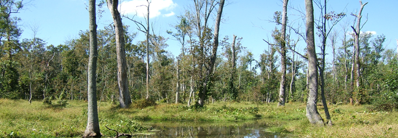
Located in Kent County, the St. Jones River watershed covers 57,643 acres of the Delaware Bay Basin. The St. Jones River is dammed at Silver Lake in Dover and then winds 10 miles through residential and commercially developed areas, the Delaware National Estuarine Research Reserve, and the Ted Harvey Wildlife Area, before emptying into Delaware Bay.
The goal of this wetland assessment project was to determine the health of both tidal and nontidal wetlands in the St. Jones River watershed, changes in wetland acreage, and to identify the presence of wetland stressors that are degrading wetlands. Data was collected between 2007 and 2008.
The data gathered during this study on wetland health, stressor information, and watershed wide trends will guide and improve future protection and restoration activities, education, and land use planning to ensure the conservation of Delaware’s wetland resources.
The wetland assessment data garnered from this study will be used to design a restoration strategy for the watershed. The plan will be developed by an interagency team of scientists and managers.
Opportunities for both increasing wetland quality and quantity in target areas will be identified by integrating the data from the wetland monitoring and assessment program with data from other strategies and efforts.
Contact the St. Jones Watershed Coordinator housed in DNREC’s Watershed Assessment Section to learn about the Tributary Action Team, upcoming watershed restoration initiatives, and the St. Jones Pollution Control Strategy.
St. Jones Watershed Coordinator: Brittany Sturgis 302-739-9939
For more information about the Condition Report, contact Alison Rogerson, at 302-739-9939.
Related Topics: assessment, river, st. jones, watershed, watershed stewardship, wetlands
Delaware's Governor
State Agencies
Elected Officials
General Assembly
Delaware Courts
State Employees
Cities & Towns
Delaware State Code
State Regulations
Business First Steps
Phone Directory
Locations Directory
Public Meetings
Voting & Elections
Transparency
Health Insurance
Tax Center
Personal Income Tax
Privacy Policy
Weather & Travel
Contact Us
Corporations
Franchise Tax
Gross Receipts Tax
Withholding Tax
Delaware Topics
Help Center
Mobile Apps
E-mail / Text Alerts
Social Media

Built by the Government Information Center
©MMXXVI Delaware.gov