

DNREC Menu
Wednesday, July 15, is a Code Orange Air Quality Action Day for Ozone for Delaware.
Miércoles, 15 de julio, es un Día de Acción de Calidad del Aire de Código Naranja por ozono para Delaware.
Mèkredi 15 jiyè, se yon Jou Aksyon Kòd Zoranj pou Kalite Lè a pou Ozòn pou Delaware. More Info
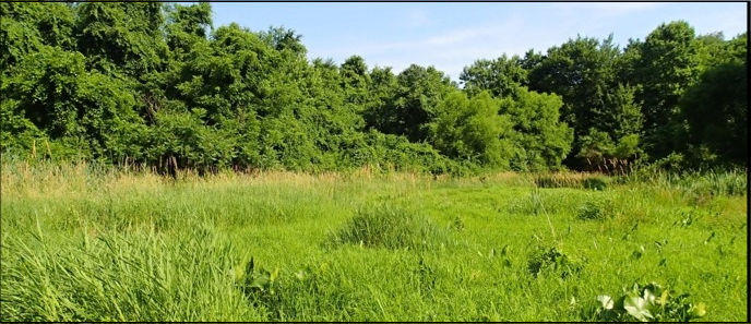
The Red Lion watershed is located within New Castle County, where it encompasses 46,283 acres (72 square miles) of land within the Delaware Bay and Estuary Basin. It is composed of the C&D Canal East, Dragon Creek, Red Lion Creek, Army Creek, and Broad Dike Canal. Approximately 16% of the land area of the watershed is covered by wetlands and dominated by tidal wetland types.
Prior to 1992 an estimated 1,375 acres of wetlands have been lost in this watershed due to conversion to other land uses such as residential or commercial development.
More recently changes have been seen in wetland community types where wetlands are being converted to open water areas due to development. This is alarming as wetlands that are void of plants do not provide the same benefits that planted wetlands provide.
Overall, the Red Lion watershed’s wetlands received a D+ for their health score. Common wetland stressors were the presence of invasive plant species, and disturbances in the buffer surrounding the wetlands including agriculture, roads, and development.
The Red Lion watershed’s wetlands acreage, condition, and value are critical for overall health and functionality.
Based on this study, several recommendations were made to improve management and encourage informed decision making. These included:
For more information about the Condition Report, contact Alison Rogerson, at 302-739-9939.
Related Topics: army creek, assessment, broad dyke, c&d canal, dragon creek, red lion, red lion creek, watershed, watershed stewardship, wetlands
Delaware's Governor
State Agencies
Elected Officials
General Assembly
Delaware Courts
State Employees
Cities & Towns
Delaware State Code
State Regulations
Business First Steps
Phone Directory
Locations Directory
Public Meetings
Voting & Elections
Transparency
Health Insurance
Tax Center
Personal Income Tax
Privacy Policy
Weather & Travel
Contact Us
Corporations
Franchise Tax
Gross Receipts Tax
Withholding Tax
Delaware Topics
Help Center
Mobile Apps
E-mail / Text Alerts
Social Media

Built by the Government Information Center
©MMXXVI Delaware.gov