DNREC Menu
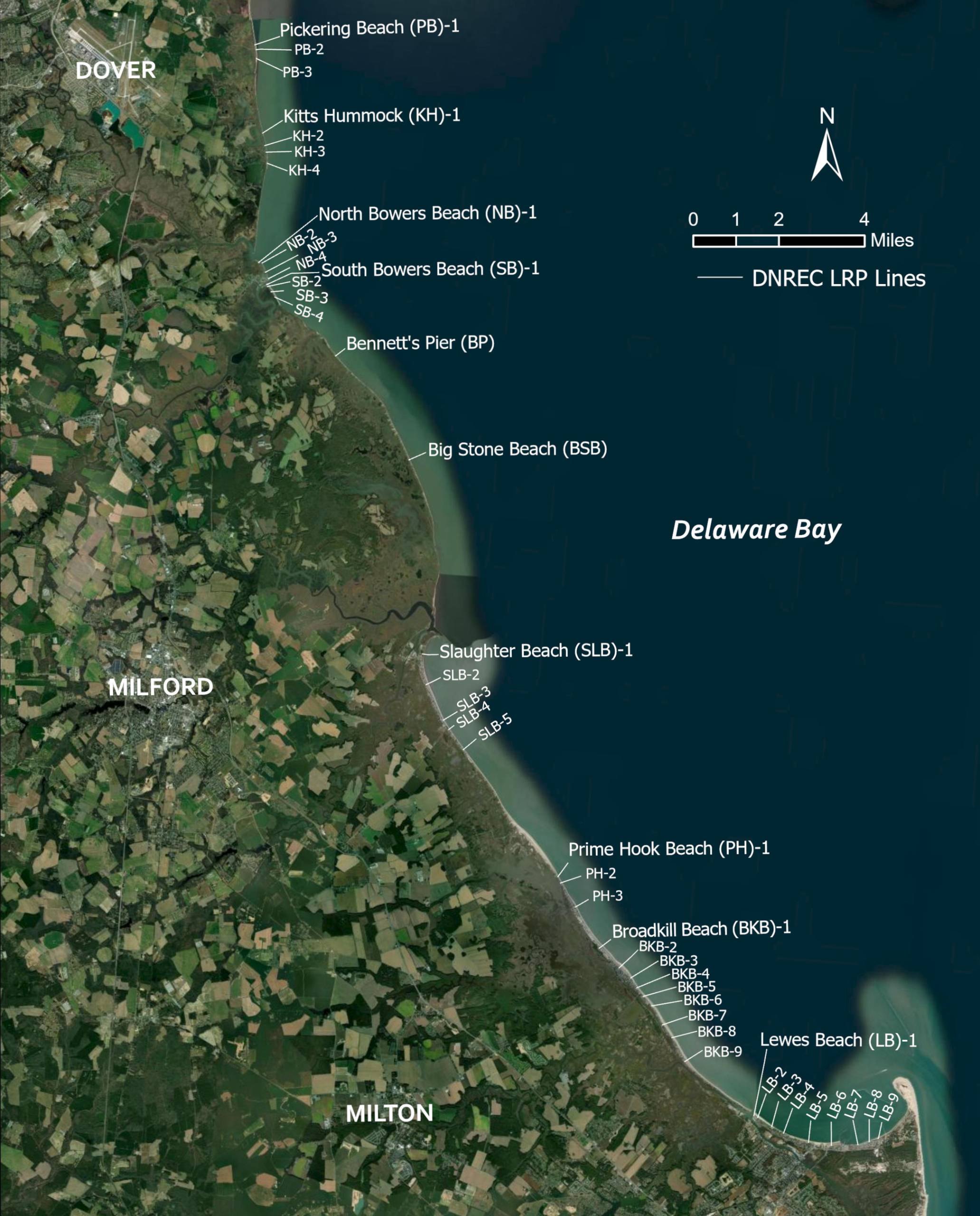
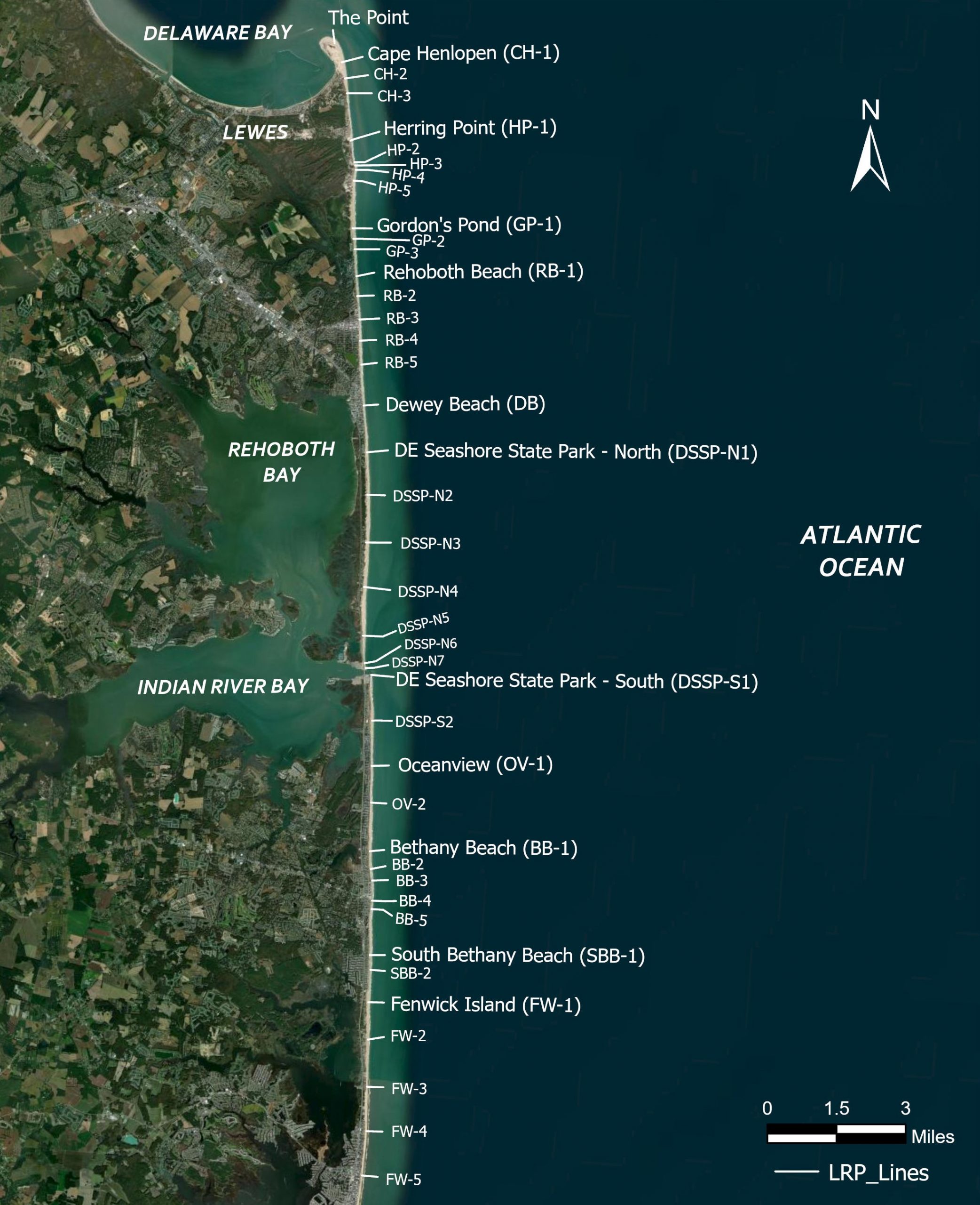
Monitoring beach change over time is a key component of shoreline management. The Shoreline and Waterway Management Section surveys over 80 profiles along Delaware’s bay and ocean coast beaches twice each year to measure seasonal and annual beach change conditions.
Survey data from points along the Bay and ocean coasts from Pickering Beach, in Kent County, to Fenwick Island, in Sussex County, are used to plan and prioritize beach repair projects and to understand long-term erosion and accretion trends.
Annual reports are published to summarize the results of the most recent beach surveys and provide insight on what causes the observed profile changes. Survey data are available upon request.
Visitors to two of Delaware’s most popular beaches can help collect valuable data needed to monitor Delaware’s changing coastline. And all they need is their smartphone to take part in the CoastSnap DE project.
CoastSnap DE is part of a global community science project that places simple camera mounts at beaches. Visitors are invited to take photos using the mounts and upload them to a central location.
Related Topics: beaches, monitoring, watershed stewardship
Delaware's Governor
State Agencies
Elected Officials
General Assembly
Delaware Courts
State Employees
Cities & Towns
Delaware State Code
State Regulations
Business First Steps
Phone Directory
Locations Directory
Public Meetings
Voting & Elections
Transparency
Health Insurance
Tax Center
Personal Income Tax
Privacy Policy
Weather & Travel
Contact Us
Corporations
Franchise Tax
Gross Receipts Tax
Withholding Tax
Delaware Topics
Help Center
Mobile Apps
E-mail / Text Alerts
Social Media

Built by the Government Information Center
©MMXXVI Delaware.gov