

DNREC Menu
Maritime activities are vital to Delaware’s blue economy, supporting jobs, economic growth and coastal communities. Marine transportation facilitates the movement of goods through the Port of Wilmington, a key regional hub. Commercial fishing and aquaculture contribute to the state’s seafood industry and cultural heritage, while military operations provide national security and generate local economic activity. Together, these sectors form the backbone of Delaware’s working waterfronts and ocean-based economy.
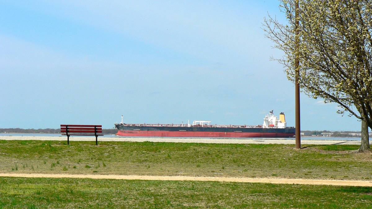
Delaware’s marine waters play a vital role in shipping and trade, supporting activities like coastal and deep-sea freight transport as well as tanker operations.
In 2021, the marine transportation industry employed nearly 9,000 people in the state. In 2022, close to 1,600 cargo ships and 3,500 tankers entered or passed through Delaware’s waters, contributing to over 22 billion tons of waterborne cargo, including imports, exports, and domestic goods.
While some ships pass through Delaware waters without stopping, most enter the Delaware Bay, highlighting the state’s importance as a key maritime hub on the East Coast.
Spatial Extent: Delaware Bay and Atlantic Ocean – primarily within Traffic Separation Schemes
Temporal Pattern: Year round
Learn more about commercial shipping in the Baseline Characterization of Uses and Resources Final Report
The Delaware River port complex, including port facilities in Pennsylvania, New Jersey and Delaware, is the largest freshwater port complex in the world. In 2024, about 2,500 commercial vessels arrived at the complex, supporting thousands of jobs.
The Port of Wilmington, located where the Delaware and Christina Rivers meet, is a deep-water facility handling a wide range of cargo including fruit, juice concentrates, automobiles, steel, and even livestock.
Wilmington also serves as the Mid-Atlantic’s key export center for cars and rail vehicles heading to regions like the Middle East, West Africa, and Central America.
Spatial Extent: Delaware River; Delaware Bay
Temporal Pattern: Year round
Sources: Delaware River Basin Commission
Learn more about port facilities in the Baseline Characterization of Uses and Resources Final Report
Lightering, a type of bulk product transfer, is the process of transferring cargo such as crude oil or other hazardous chemicals from one vessel to another vessel to reduce a vessel’s draft to travel upriver, or to transfer product to smaller vessels capable of entering ports. It is regulated by 7 Del. Admin. Code § 1124-46.0.
Spatial Extent: Prohibited in Delaware waters, except in specific cases, in accordance with the Delaware Coastal Zone Act.
Temporal Pattern: Year round
Learn more about lightering sites in the Baseline Characterization of Uses and Resources Final Report
Areas adjacent to Traffic Separation Schemes (TSS) shipping lanes. Anchorage grounds provide a safe area for ships waiting to enter or exit the Delaware Bay and River. They are regulated by the United States Coast Guard.
Spatial Extent: There are nine anchorage areas established in the Planning Area off Delaware’s coast: Seven in the Delaware River and Bay; and two in the Atlantic Ocean.
Temporal Pattern: Year round
Learn more about anchorage areas in the Baseline Characterization of Uses and Resources Final Report

Ferries in Delaware offer scenic and essential transportation across the Delaware Bay and River, connecting people, vehicles and goods between key destinations.
The Delaware River & Bay Authority operates two services: the Cape May-Lewes Ferry, which links Lewes, Delaware and Cape May, New Jersey year-round, and the seasonal Forts Ferry Crossing.
Each year, the Cape May-Lewes Ferry carries over 250,000 vehicles and 750,000 passengers, supporting tourism and local economies. The Cape May-Lewes Ferry route was designated as a Marine Highway in 2020. The Ferry transports approximately 7,000 commercial trucks yearly, removing around 169 highway round-trip miles and 3 hours of travel per trip.
Spatial Extent: Delaware Bay
Temporal Pattern: Year round
Learn more about passenger ferries in the Baseline Characterization of Uses and Resources Final Report
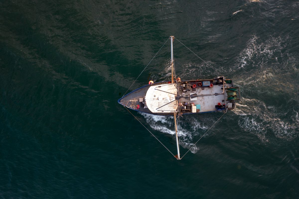
Commercial fishing is an important part of Delaware’s maritime industry, using both seafloor-contact gear (benthic) and open-water gear (pelagic) to target a variety of valuable species.
Benthic gear is used to catch species like blue crabs, oysters, sea scallops, and whelks, while pelagic gear such as gillnets and longlines targets fish like Atlantic mackerel, menhaden, and tuna.
Pelagic fishing activity is less prevalent than benthic gear fishing in the Planning Area.
From 2011 to 2020, Delaware’s commercial fisheries landed an average of 4.9 million pounds of seafood annually, generating an average of $9.1 million annually in revenue. Shellfish, particularly blue crabs, made up the bulk of the catch and value.
Advanced tools like Automatic Identification System (AIS), Vessel Monitoring Systems (VMS) and Vessel Trip Reports (VTR) help monitor fishing activity, with around 2,000 commercial fishing vessels observed in the region each year.
Spatial Extent: Benthic gear fishing is present throughout the Planning Area. Most of the bottom trawl fishing presence is concentrated along the outer continental shelf (OCS) break and slope, dredge gear fishing presence occurs on the OCS and pots and traps gear fishing is concentrated coastward of the 40m bathymetric contour line. Pelagic fishing activity is less prevalent than benthic gear fishing in the Planning Area.
Temporal Pattern: Unknown
Learn more about commercial fishing in the Baseline Characterization of Uses and Resources Final Report
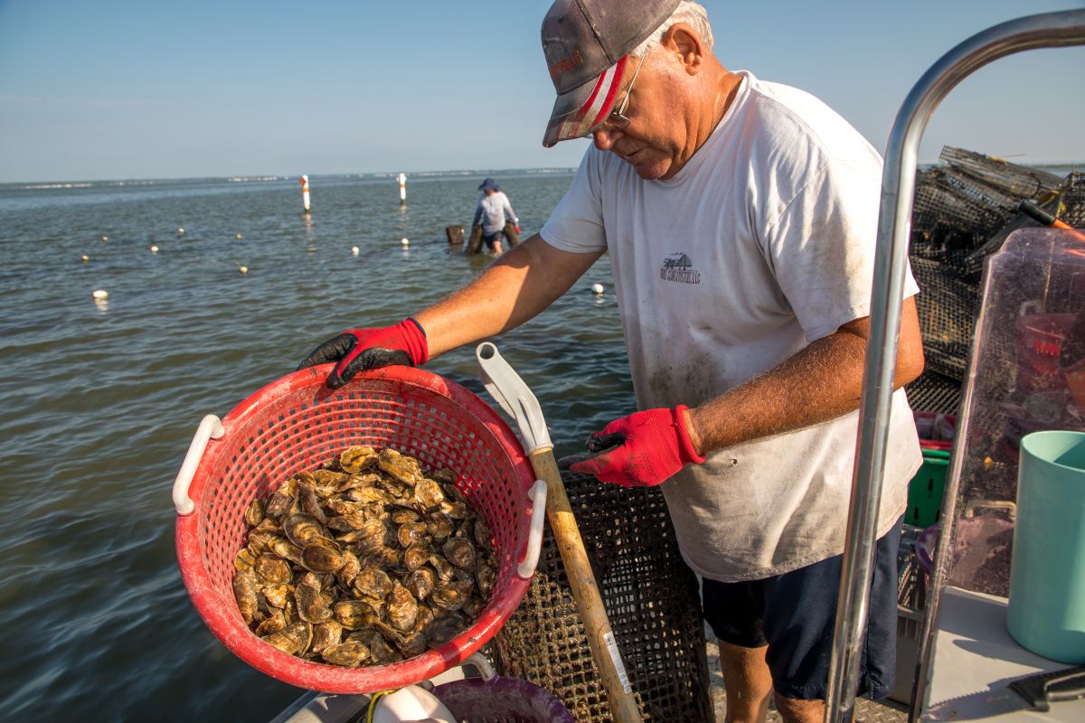
Oyster farming along Delaware’s shoreline supports local jobs, helps restore oyster populations, and improves coastal water quality. Delaware also cultivates other shellfish like clams and mussels, with clams thriving in both intertidal and subtidal zones.
Harvest of bivalve shellfish (clams, mussels, and oysters) is controlled in specific areas throughout the state, based on water quality. While commercial harvesting of oysters is permitted, recreational harvesting is not.
At the end of 2024, there were 24 acres leased within the Rehoboth Bay.
Spatial Extent: Inland Bays; Delaware Bay (South of the East Line and North of the Murderkill River)
Temporal Pattern: Year round
Learn more about aquaculture in the Baseline Characterization of Uses and Resources Final Report

Military Operations Areas (OPAREAs) are designated zones where national defense training and testing take place, coordinated across federal, state and local agencies.
Off Delaware’s coast, these areas include both active and historical military zones, such as the North and South Firing Ranges, which were used by the Delaware National Guard until the 1970s. Some of these sites contain munitions and explosives of concern (MEC), including unexploded ordnance and discarded military munitions, posing potential risks to people and the environment.
Although ocean dumping of munitions was banned in 1972, the exact locations of many MECs remain unknown, and efforts to map, monitor and address them continue today.
Military activities in the region currently occur offshore in the Virginia Capes and Atlantic City OPAREAs.
Spatial Extent: Delaware Bay and Atlantic Ocean
Temporal Pattern: Year round
Learn more about military activities in the Baseline Characterization of Uses and Resources Final Report
Related Topics: activity guide, atlantic ocean, bay, climate coastal energy, coastal management, coastal programs, delaware bay, economy, marine resources, ocean, planning
Delaware's Governor
State Agencies
Elected Officials
General Assembly
Delaware Courts
State Employees
Cities & Towns
Delaware State Code
State Regulations
Business First Steps
Phone Directory
Locations Directory
Public Meetings
Voting & Elections
Transparency
Health Insurance
Tax Center
Personal Income Tax
Privacy Policy
Weather & Travel
Contact Us
Corporations
Franchise Tax
Gross Receipts Tax
Withholding Tax
Delaware Topics
Help Center
Mobile Apps
E-mail / Text Alerts
Social Media

Built by the Government Information Center
©MMXXVI Delaware.gov