DNREC’s Delaware Coastal Programs conducts long-term monitoring to help understand the coastal environment. The data collected provide insights into complex estuarine ecosystems. They help local and national leaders understand the vulnerability and resilience of our coast — and the effects of a changing climate.
302-739-6377
The Delaware National Estuarine Research Reserve (DNERR) collects nationally standardized data as part of the National Estuarine Research Reserve System (NERRS).
This includes long-term abiotic data through the System-Wide Monitoring Program (SWMP) and Sentinel Site Application Module (SSAM-1) data to understand coastal habitat responses to changing water levels.
The System-Wide Monitoring Program (SWMP) is a cornerstone of all 30 National Estuarine Research Reserve sites. It has two major goals.
To support and establish local networks of continuous water quality, nutrient, and meteorological monitoring stations in representative protected estuarine ecosystems.
To help develop a nation-wide database of environmental conditions in the diverse estuarine habitats throughout the United States as represented by the NERR system.
Water quality monitoring is performed within the Blackbird Creek and St. Jones River watersheds using YSI EXO2 water quality sondes along the salinity gradient.
Three stations are established along the St. Jones River at the following locations: Scotton Landing, Lebanon Landing, and Division Street. There is a fourth station located within a tributary along the St. Jones Reserve boardwalk.
Three stations are established along the Blackbird Creek at the following locations: Blackbird Landing, Beaver Branch, and Taylor’s Bridge.
Parameters are measured at a 15-minute frequency at each site and include: water temperature, specific conductivity, salinity, dissolved oxygen concentration and percent saturation, pH, turbidity, and water level reference to NAVD88.
Water quality data from Scotton Landing is available in real-time. Data can be accessed through the Centralized Data Management Office or upon request to the DNERR.
Meteorological monitoring takes place with a Campbell Scientific weather station located on the St. Jones Reserve boardwalk near the DNERR visitor center and at the Blackbird Creek within a meadow along the walking trails.
Measurements are taken in 15-minute intervals including: air temperature, relative humidity, barometric pressure, photosynthetically active radiation, precipitation, wind speed, and wind direction.
Meteorological data is available in real-time. Data can be accessed through the Centralized Data Management Office or upon request to the DNERR.
Nutrient monitoring occurs at six of the seven water quality stations via monthly grab samples. Additional diel samples are collected at the Scotton Landing site through the use of an automated Isco sampler over a tidal cycle.
Each sample is analyzed offsite by the DNREC Environmental Laboratory for the following nutrients and plant pigments: orthophosphate, nitrite + nitrate, nitrite, nitrate, ammonium, dissolved inorganic nitrogen, silica, chlorophyll-a, and pheophytin.
Data can be accessed through the Centralized Data Management Office or upon request to the DNERR.

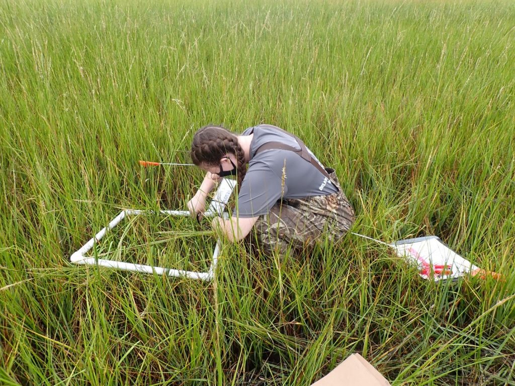
Long-term transects are established at both the St. Jones and Blackbird Creek Reserves in an effort to monitor tidal marsh vegetation changes over time.
Fixed points are assessed along each transect for vegetative species composition, stem density, vegetation height, elevation, and soil bearing capacity.
Monitoring occurs biennially and began in 2012 for the St. Jones Reserve and 2016 for Blackbird Creek Reserve.
A series of surface elevation tables are located along the St. Jones and Blackbird Creek Reserves to monitor changes in marsh surface elevation at the millimeter level.
Surface elevation tables are measured twice a year and include deep rod, shallow rod and feldspar clay marker data.
Elevation data is critical for assessing marsh vulnerability to sea level changes.
Elevation data is available upon request to Delaware Coastal Programs.
Marsh bird surveys are conducted monthly, May through July, at fixed callback locations along the St. Jones River.
These surveys use the Saltmarsh Habitat and Avian Research Program (SHARP) protocol to assess the presence of important marsh birds such as the clapper rail.
These surveys will help in local and regional efforts to understand the status of these important organisms, especially in the face of sea level rise.
Nekton biodiversity (aquatic animals that are able to swim and move independently) is monitored along a salinity gradient in Blackbird Creek by conducting monthly trawl surveys from April through October.
Surveys count, identify, and size the collected fish, crab, and shrimp species.
This project began in 2017 will the goal to establish a long-term data set to assess patterns of biodiversity as well as the presence or absence of species.
Related Topics: coastal, data, management, monitoring, ocean and coasts, science