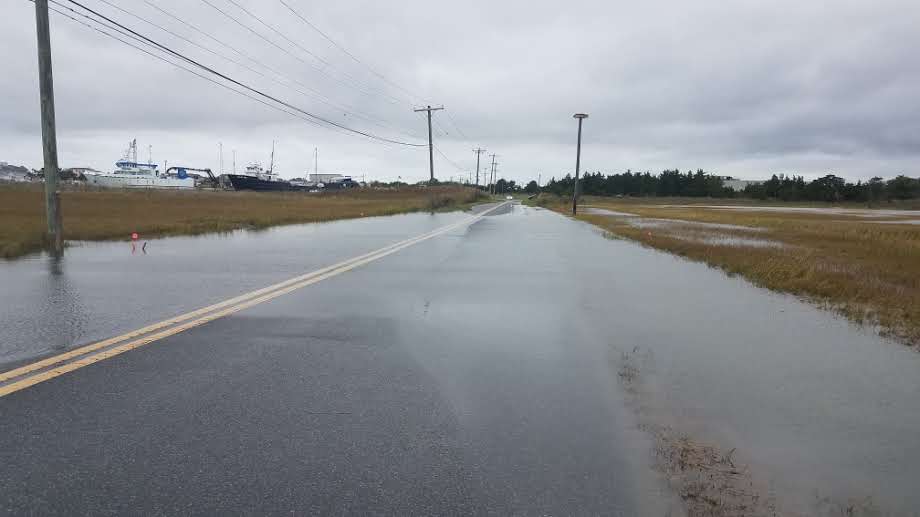
The Department of Natural Resources and Environmental Control (DNREC) has undertaken an investigation of flood mitigation options for the section of Pilottown Road, in Lewes, that crosses Canary Creek near its confluence with the Broadkill River.

The section of Pilottown Road leading to the Canary Creek bridge is frequently inundated by water during nuisance flood events caused by east and northeast winds. At times, the flood depths make the road impassable. Even when flood depths are shallow, the roadway can be damaged. And the potential for flash flooding or swiftly moving water may pose a high risk.
This bridge is the only land access to DNREC’s Lewes Field Facility, the Coast Guard Station, a University of Delaware facility and other businesses.
This flooding problem prompted DNREC to pursue a Hazard Mitigation Grant to investigate mitigation options. The grant was awarded in 2020. In 2021, DNREC entered a partnership with DelDOT to conduct the study. The consultant company AECOM was given the job of performing the engineering design and alternatives analysis with input from and oversite by both DNREC and DelDOT.
The most straightforward way to mitigate roadway flooding is to elevate the road above flood levels. There are two key technical questions that must be answered about elevating the roadway.
A geotechnical investigation concluded that the underlying soil could support an increase in roadway elevation up to 2.5 feet. This would bring the minimum road elevation to just above the 10-year flood elevation.
A coastal flood model shows that an increase in flood elevations in the area adjacent to the project would not occur during nuisance and 100-year or more extreme events. There is a negligible increase in flood elevation, up to 6 inches, on the marshy, uninhabited peninsula between the roadway and Roosevelt Inlet (shown in blue).
The next steps are to complete a cost/benefit analysis and a review of alternative solutions. The partners will then apply for a Pre-Disaster Mitigation Grant to continue the project, complete engineering and design work, and apply for needed permits.
For more information, contact Joe Faries, DNREC Shoreline and Waterway Management Section, at 302-739-9126.
Related Topics: drainage, flood, flooding, Health and Safety, mitigation, study, watershed stewardship, waterways