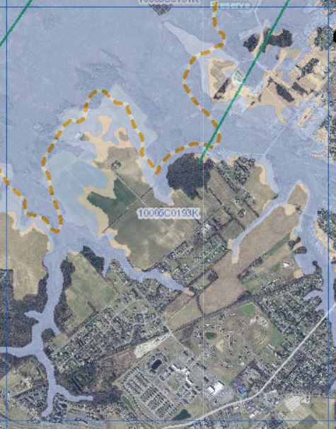
The DNREC Floodplain Management Program works with FEMA to improve the accuracy of Flood Insurance Rate Maps, which were originally created in the 1970s, and to provide technical support pertaining to flood risk.
302-608-5500
FEMA maps floodplains in the United States as part of the National Flood Insurance Program (NFIP). It uses these maps, called Flood Insurance Rate Maps (FIRMs), to delineate low, moderate, and high flood risk areas and to establish where the mandatory flood insurance purchase requirement applies. Communities and local governments use them to manage flood risk. The maps are updated when there are changes in a watershed or stream or when better data or modeling is available.
DNREC works closely with FEMA, as a Cooperating Technical Partner (CTP), on projects to update Flood Insurance Rate Maps when new data are available or when changes on the ground occur that might affect the potential and course of flooding.
The FEMA CTP Program is an innovative approach to creating partnerships between FEMA and participating NFIP communities, regional agencies, state agencies, tribes and universities that have the interest and capability to become more active participants in the FEMA flood hazard mapping program. DNREC has a CTP agreement with FEMA which facilitates flood risk management activities including floodplain mapping.

The Delaware Flood Planning Tool offers an interactive, online map to help research flood risk for properties in Delaware. It is designed to help floodplain managers, insurance agents, developers, real estate agents, engineers, surveyors, local planners and citizens make informed decisions about the degree of flood risk for a specific area or property.
The FEMA Flood Map Service Center (MSC) is an official public source for flood hazard information produced in support of the National Flood Insurance Program (NFIP). It offers tools to find official flood maps, access a range of other flood hazard products, and take advantage of tools for better understanding flood risk.
The National Flood Hazard Layer Viewer is an interactive, online map that displays the official effective national flood hazard data.
To learn more about flood risk and floodplain mapping, explore FEMA’s Flood Risk Communication Toolkit.
Most recently, the floodplains along Bundicks Branch were re-studied and mapped. These maps went effective in October of 2022.
Currently, work is being done by FEMA to update FIRMs along Tidbury Creek and its tributaries, Puncheon Run, Isaac Branch, and Iron Mine Prong and its tributary in Kent County.
In Sussex County, Round Pole Branch and its tributary are being re-studied.
In 2019, DNREC initiated a study to revise the floodplain mapping for Clear Brook, near Seaford in Sussex County. After public comment, the Letter of Map Revision (LOMR) went effective in August of 2021.
Through the Cooperating Technical Partner program, DNREC updated portions of New Castle, Kent, and Sussex County floodplain maps. The Kent and Sussex map updates became effective in June 2018. The New Castle County map updates became effective in January 2020.
In 2016, two FIRM map panels in New Castle County were updated after DNREC performed a floodplain study and submitted a Letter of Map Revision (LOMR) to FEMA. The panels cover a floodplain for a tributary of the south branch of Naaman Creek, generally located in the Brandywood and adjacent communities. The map updated panels are Panel 10003C0059J and Panel 10003C0078J.
Related Topics: drainage and flooding, flood insurance, flooding, floodplain, Health and Safety, mapping, maps, watershed stewardship