

DNREC Menu
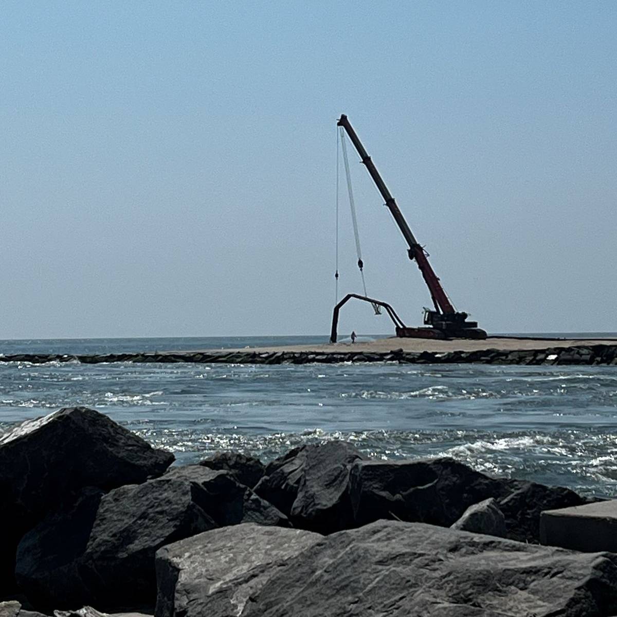
The Indian River Inlet Sand Bypass System is ready to start pumping sand again, after an upgrade from diesel power to electric. prep work requires periodic closures and access restrictions on both the North and South sides of the inlet and within Delaware Seashore State Park.
Updated: March 4, 2026
Most of the park remains open, but visitors and recreationalists should avoid all marked work zone areas. Entering these areas is dangerous and is strictly prohibited. Do Not Enter signs are being placed strategically and beachgoers disregarding the signs may be prosecuted.
Current operations are expected to run through May 15, 2026. The system normally will operate from Labor Day to Memorial Day.
The plant is operated by First State Crane Service, Inc. under contract to the DNREC Shoreline and Waterway Management Section and under a long-term agreement between the U.S. Army Corps of Engineers (USACE) and the State of Delaware.
The plant moves sand from the south side of the Indian River Inlet to the north side, using an aboveground system of pipes to replace sand on the inlet’s northern beach.
The system helps recreate the natural flow of sand along the Delaware Atlantic Ocean Coast that is interrupted by the Indian River Inlet jetties, built the Corps of Engineers in 1939.
Typically, sandy coasts along large bodies of water tend to see sediment (small pieces of sand, rock, mud, pebbles, minerals, fossils and/or plants) transported in one direction, a process known as littoral drift.
Along Delaware’s Atlantic Ocean shoreline, littoral drift is continually moving sand from the south to the north. This is evident in the large sandbar that forms the point of Cape Henlopen, where the shoreline is interrupted by the mouth Delaware Bay. The point has been slowly formed by decades of sand deposited by littoral drift.

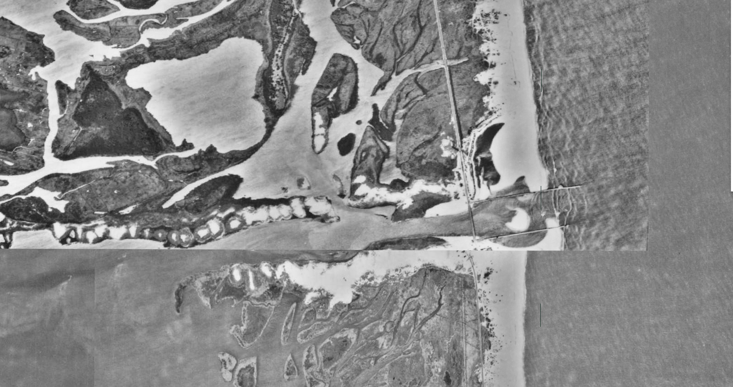
The Indian River Inlet used to be a small natural inlet that cut across the coastal barrier beach between the Atlantic Ocean and the Inland Bays, connecting the two bodies of water.
Inlets are naturally dynamic. They are constantly shaped and reshaped by coastal currents. This naturally moving sand helps prevent erosion, the gradual wearing away of the sand sediment by the wind and waves, by consistently replacing sections of lost beach.
The inlet moved from place to place along the barrier island, opened and closed by coastal storms and natural processes.
However, Congress authorized a study in 1935 to determine if a stabilized inlet was feasible to provide dependable and safe navigation between the ocean and the bays in Delaware.
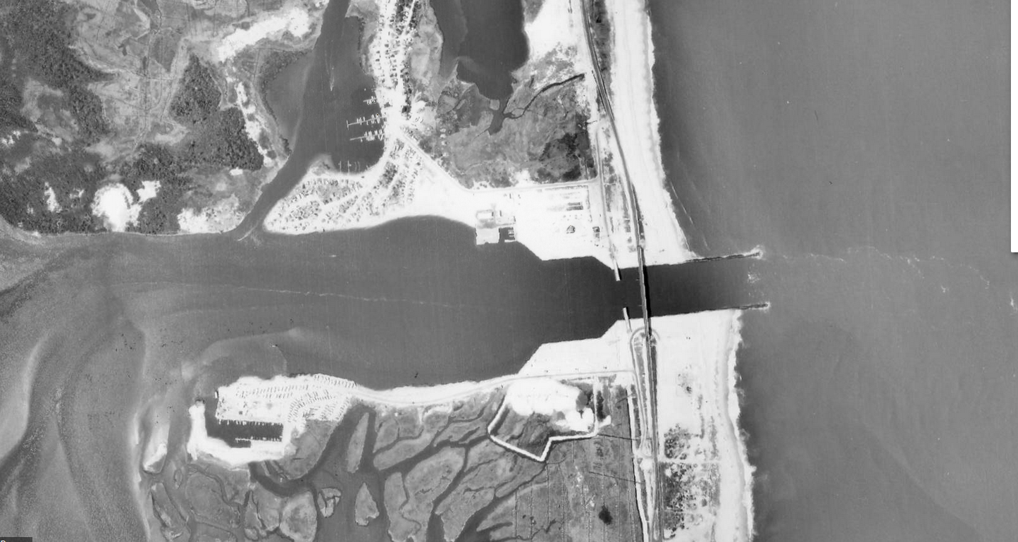
By 1937, there were early, steel jetties in place to try to keep the inlet open.
In 1939, the U.S. Army Corps of Engineers built stone jetties (long, narrow stone structures that run from onshore into the water) on each side of the inlet to provide stability to the newly dredged inlet.
The change was largely positive and stabilized the inlet. But it also disrupted the natural northward flow of sand along the beach.
As a result, the beach on the north side of the inlet experiences continuous erosion caused by littoral drift, regardless of whether new sand arrives from the south, as well as the natural coastal processes driven by wind, waves, and tides.
This is particularly problematic, and increasingly noticeable, given that Delaware is the lowest-lying state in the U.S. and is particularly vulnerable to the impacts of sea level rise.
Now, with two strong jetties, each stretching several hundred feet out into the ocean, there is no natural transfer of sand from south to north at the Inlet. Instead, there is accelerated erosion on the north side and a buildup of sediment on the south.
In 2025, DNREC completed an emergency dredging and beach repair project at the North Indian River Inlet Beach.
Learn more about the history of the Indian River Inlet in a Feb. 2020 post on the Delaware State Parks Adventure Blog, by Delaware Seashore State Park Interpreter Kenneth Horowitz: History of the Indian River Inlet at Delaware Seashore State Park
In the 1980s, to solve this imbalance, the Army Corps of Engineers Philadelphia District, in conjunction with DNREC, created a diesel-powered mechanical sand bypass system. The system was completed and turned over to DNREC to operate in 1990.
DNREC has since updated the system to electric power, which was completed in 2025.
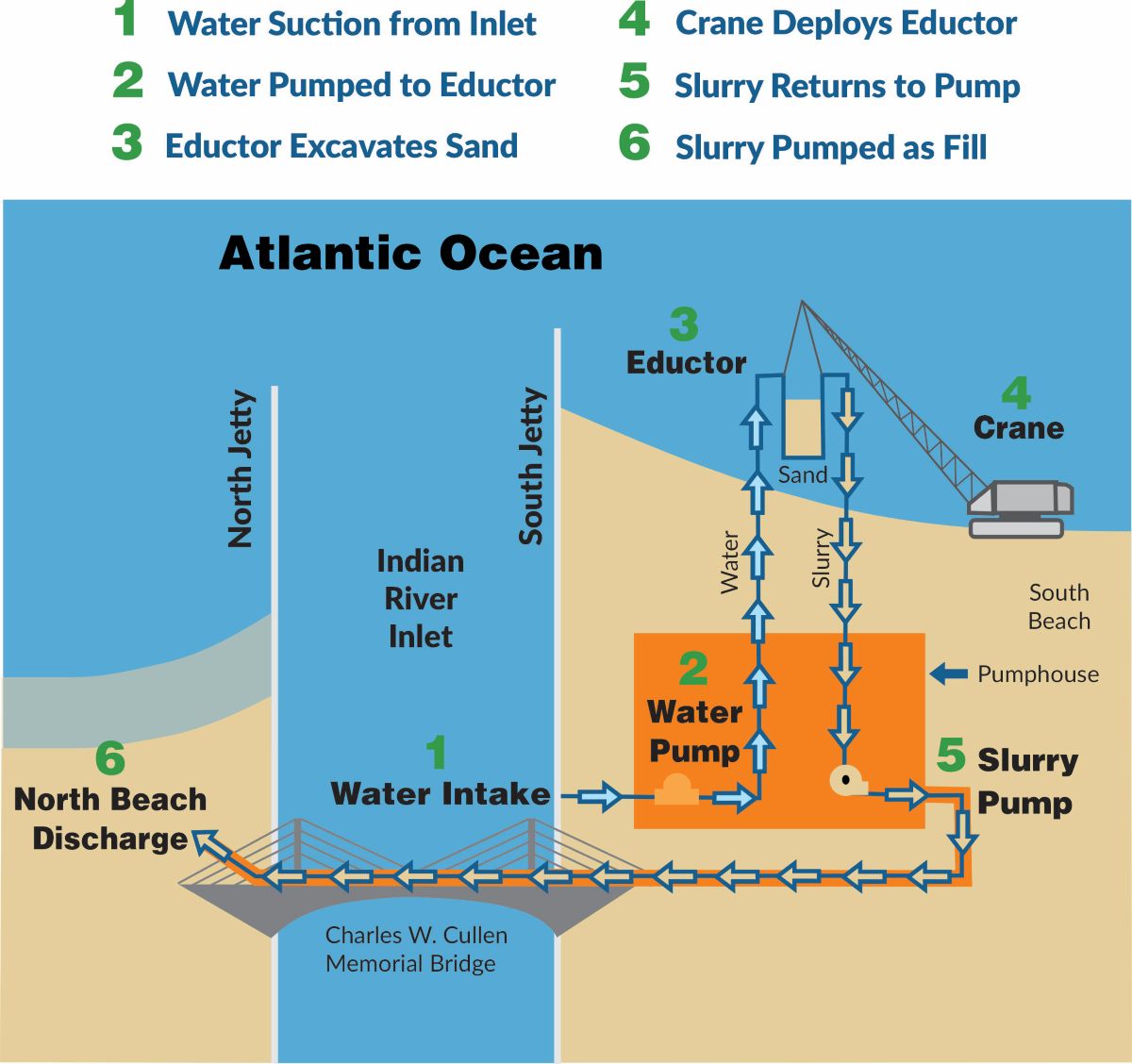
Using water from the inlet, a jet pump collects a sand-rich slurry from the intertidal zone of the beach on the south side of the inlet. This is the part of the beach that is under water at high tide and just above water at low tide.
The system pumps this slurry through above-ground pipes to the eroding north side, where it is distributed on the beach. Over 6,000 gallons a minute moves from the south side of the inlet to the north side during regular operation.
The sand bypass system pumps on average of 100,000 cubic yards of slurry every year, the equivalent of about 12 Olympic swimming pools or 18,000 dump trucks.
This transported sand slurry mimics the natural littoral drift blocked by the jetties and helps the beach renourish itself.
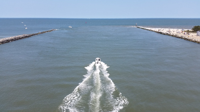
The sand bypass helps preserve the Indian River Inlet which facilitates safe transit between the Inland Bays and the Atlantic Ocean for recreational and commercial vessels.
The bypass helps recreate the natural processes that maintain the slender beach and dune barrier between the ocean and the bays in this area, which carries a critical transportation corridor, Delaware Route 1. The highway connects Delaware’s northern and southern beach communities, provides a lifeline for emergency services, and is a designated evacuation route for the entire Delmarva Peninsula.
The jetties also offer accessible fishing opportunities. The beaches on each side of the inlet are popular tourist destinations, helping to support local families and businesses while strengthening visitors’ connection with the coast.
Related Topics: beach nourishment, beaches, ocean and coasts, sand bypass system, shorelines, watershed, watershed stewardship
Delaware's Governor
State Agencies
Elected Officials
General Assembly
Delaware Courts
State Employees
Cities & Towns
Delaware State Code
State Regulations
Business First Steps
Phone Directory
Locations Directory
Public Meetings
Voting & Elections
Transparency
Health Insurance
Tax Center
Personal Income Tax
Privacy Policy
Weather & Travel
Contact Us
Corporations
Franchise Tax
Gross Receipts Tax
Withholding Tax
Delaware Topics
Help Center
Mobile Apps
E-mail / Text Alerts
Social Media

Built by the Government Information Center
©MMXXVI Delaware.gov